Geography
Geography – Intent
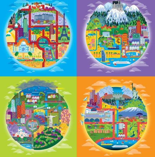
At Brampton Primary School we aim to provide a high-quality geography education through our UNITY Curriculum, that inspires in pupils a curiosity and fascination about the world and its people that will remain with them for the rest of their lives. Teaching will equip pupils with knowledge about diverse places, people, resources and natural and human environments, together with a deep understanding of the Earth’s key physical and human processes.
As pupils progress, their growing knowledge about the world will help them to deepen their understanding of the interaction between physical and human processes, and of the formation and use of landscapes and environments. Geographical knowledge, understanding and skills provide the frameworks and approaches that explain how the Earth’s features at different scales are shaped, interconnected and change over time.
Spaced Retrieval Practice Approach
Our curriculum is structured to introduce and revisit knowledge, following the principles of instruction, guided by understanding how the memory works and cognitive load theory.
Aims of the Geography Curriculum
The national curriculum for Geography aims to ensure that all pupils:
- develop contextual knowledge of the location of globally significant places – both terrestrial and marine – including their defining physical and human characteristics and how these provide a geographical context for understanding the actions of processes
- understand the processes that give rise to key physical and human geographical features of the world, how these are interdependent and how they bring about spatial variation and change over time
- are competent in the geographical skills needed to:
- collect, analyse and communicate with a range of data gathered through experiences of fieldwork that deepen their understanding of geographical processes
- interpret a range of sources of geographical information, including maps, diagrams, globes, aerial photographs and Geographical Information Systems (GIS)
- communicate geographical information in a variety of ways, including through maps, numerical and quantitative skills and writing at length.
Key Stage One
Pupils will develop knowledge about the world, the United Kingdom and their locality. They will understand basic subject specific vocabulary relating to human and physical geography and begin to use geographical skills, including first-hand observation, to enhance their locational awareness.
Geographical Knowledge and Skills
Across Key Stage One, pupils will be taught to:
Locational knowledge
- name and locate the world’s seven continents and five oceans
- name, locate and identify characteristics of the four countries and capital cities of the United Kingdom and its surrounding seas.
Place knowledge
- understand geographical similarities and differences through studying the human and physical geography of a small area of the United Kingdom, and of a small area in a contrasting non-European country.
Human and physical geography
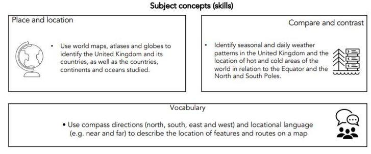
- identify seasonal and daily weather patterns in the United Kingdom and the location of hot and cold areas of the world in relation to the Equator and the North and South Poles
- Use basic geographical vocabulary to refer to:
- key physical features, including: beach, cliff, coast, forest, hill, mountain, sea, ocean, river, soil, valley, vegetation, season and weather
- key human features, including: city, town, village, factory, farm, house, office, port, harbour and shop
- Geographical skills and fieldwork
- use world maps, atlases and globes to identify the United Kingdom and its countries, as well as the countries, continents and oceans studied at this key stage.
- use simple compass directions (North, South, East and West) and locational and directional language [for example, near and far; left and right], to describe the location of features and routes on a map.
Key Stage Two
Pupils should extend their knowledge and understanding beyond the local area to include the United Kingdom and Europe, North and South America. This will include the location and characteristics of a range of the world’s most significant human and physical features. They should develop their use of geographical knowledge, understanding and skills to enhance their locational and place knowledge.
Geographical Knowledge and Skills
Across Key Stage Two, pupils will be taught to:
Locational knowledge
- locate the world’s countries, using maps to focus on Europe (including the location of Russia) and North and South America, concentrating on their environmental regions, key physical and human characteristics, countries, and major cities
- name and locate counties and cities of the United Kingdom, geographical regions and their identifying human and physical characteristics, key topographical features (including hills, mountains, coasts and rivers), and land-use patterns; and understand how some of these aspects have changed over time
- identify the position and significance of latitude, longitude, Equator, Northern Hemisphere, Southern Hemisphere, the Tropics of Cancer and Capricorn, Arctic and Antarctic Circle, the Prime/Greenwich Meridian and time zones (including day and night).
Place knowledge
Understand geographical similarities and differences through the study of human and physical geography of a region of the United Kingdom, a region in a European country, and a region within North or South America.
Human and physical geography
- describe and understand key aspects of:
- physical geography, including: climate zones, biomes and vegetation belts, rivers, mountains, volcanoes and earthquakes, and the water cycle
- human geography, including: types of settlement and land use, economic activity including trade links, and the distribution of natural resources including energy, food, minerals and water
Geographical skills and fieldwork
• use maps, atlases, globes and digital/computer mapping to locate countries and describe features studied
• use the eight points of a compass, four and six-figure grid references, symbols and key (including the use of Ordnance Survey maps) to build their knowledge of the United Kingdom and the wider world
• use fieldwork to observe, measure, record and present the human and physical features in the local area using a range of methods, including sketch maps, plans and graphs, and digital technologies.
Geography - Implementation
Modular Approach – Knowledge
At Brampton Primary School, Geography is taught across each year group in modules through our UNITY Curriculum that enables pupils to study in depth key geographical understanding, skills and vocabulary. Each module aims to activate and build upon prior learning to ensure better cognition and retention. Each module is carefully sequenced to enable pupils to purposefully layer learning from previous sessions to facilitate the acquisition and retention of key geographical knowledge. Each module is revisited either later in the year or in the following year as part of a spaced retrieval practice method to ensure pupils retain key knowledge and information.

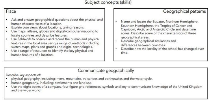
Subject Skills
As well as ensuring pupils are taught key knowledge, each module is designed to offer pupils the opportunity to develop their skills as a geographer in asking questions, planning and carrying out fieldwork, collecting and analysing information and drawing conclusions.
Example of a KS1 Module
Example of a Lower KS2 Module
Cumulative Quizzing (Supporting Cognitive Load)
At the start of each module, pupils undertake a short quiz, using platforms such as Socrates, to establish prior knowledge and understanding of the module content. Throughout each module pupils continually revisit previous content to reinforce key knowledge and vocabulary. At the end of the module, pupils take another quiz to check their understanding and knowledge.
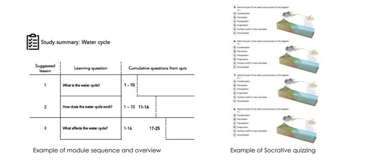
Planning
All modules have a sequenced overview outlining recommended number of sessions, key concepts, knowledge and vocabulary to be taught. Teachers use this overview to plan individual sessions approximately 45-50 minutes in length. All planning is produced using UNITY documents which incorporates cooperative learning techniques, key vocabulary, core concepts and a class profile to enable all teaching staff to effectively plan and support the needs of all pupils in the classroom.
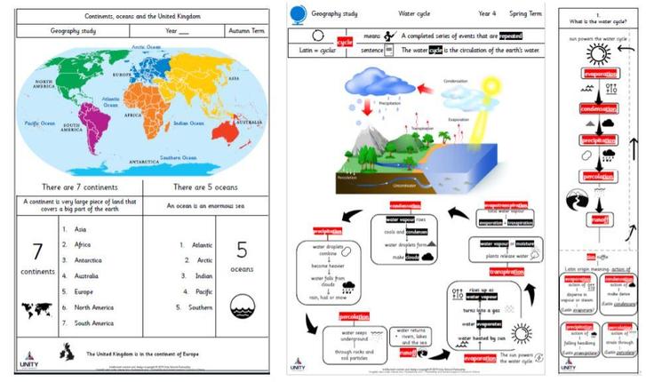
Knowledge Organisers and Knowledge Notes
Accompanying each module is a Knowledge Organiser which contains key vocabulary, information and concepts which all pupils are expected to understand and retain. Knowledge notes are the elaboration and detail to help pupils acquire the content of each module. They support vocabulary and concept acquisition through a well-structured sequence that is cumulative. Each Knowledge Note begins with questions that link back to the cumulative quizzing, focussing on key content to be learnt and understood. Knowledge Organisers and Knowledge Notes are dual coded to provide pupils with visual calls to aid understanding and recall.
Knowledge Organisers and Knowledge notes are referenced throughout each module and copies of the Knowledge Organiser are sent home to families to support with home learning.
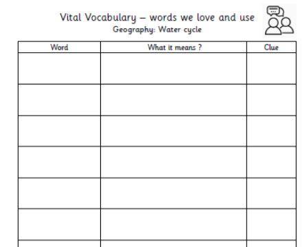
Vocabulary
Vocabulary forms a key part of our wider curriculum. Subject specific Tier 2 and Tier 3 words are incorporated in each module and pupils are encouraged to develop their own ‘Vital Vocabulary’ lists along with dual coding to expand their geography vocabulary repertoire.
Writing
Pupils are encouraged to write across all areas of the curriculum and teachers model how to write purposefully in each subject using key structures and vocabulary. Pupils are encouraged to use their UNITY curriculum books as reference books, using previous work, knowledge organisers and knowledge notes.
Geography – Impact
Assessing Knowledge and Understanding
Cumulative Quizzing At the start of each module, pupils undertake a short quiz, using platforms such as Socrates in Years 3-6 or a verbal assessment (Years 1-2), to establish prior knowledge and understanding of the module content. Throughout each module pupils continually revisit previous content and quizzing to reinforce key knowledge and vocabulary. At the end of the module, pupils take another quiz to check their understanding and Knowledge. Baseline scores are compared with end of module results with an aim for 80% retention by most pupils.

Ongoing Teacher Assessment
Pupils who are identified as needing support will be supported either during post teaching interventions or in the following session as appropriate. Pupils working at above expected standard will also be identified and challenged appropriately to extend their learning. Evidence of this support or challenge and necessary feedback will be clear in books. Teachers will then track children’s progress on Flic- an assessment tool designed to capture children’s attainment, recording groups of children and identifying gaps in learning.
Fairtrade
Over the past few years we have worked hard at Brampton Primary School to build evidence and gain our Fairacheiver award as part of the Fairtrade Foundation. Brampton itself is Fairtrade Town and we believe it is important to support and encourage children to be aware of the issues surrounding Fairtrade and why it is important to encourage critical thinking into important matters that effect our world and the people in it. We celebrate Fairtrade Fortnight every year with popular events and embed leaning into our curriculum.
Fairtrade issues link closely to Humanities as it is stated on the Fairtrade School website-
“Learning through Fairtrade opens up a fascinating world, revealing how we are all connected.”

The Woodland Trust - Green Tree Gold Award
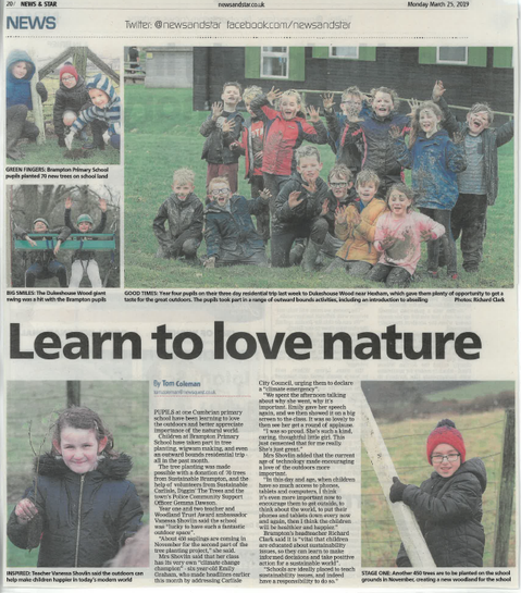
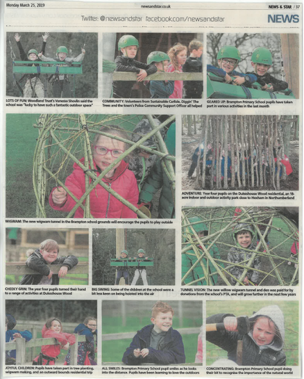
We are very lucky at Brampton Primary School to have such a fantastic outside space with plenty of amazing woodland areas right on our doorstep. We have seen this opportunity and used it to work with the Woodland Trust through the awards recently moving to Gold status. Along with the weekly mile that the children enjoy as part of keeping active, we have explored our local woodland and have created artwork linked to relevant texts, used ICT to take photographs and written poetry based on forests and changing seasons.
Woodland Trust Schools and Communities Engagement Manager Karen Letten said:
“It’s fantastic that so many schools want to engage with nature and instil a passion for the environment in their children.”
“Outdoor learning has been shown to improve pupil engagement with many youngsters going on to remember their experiences well into adulthood.”
“Our free Green Tree Schools Award is the perfect way for them to get hands on, to explore the natural world around them, use their imaginations and have fun while learning”